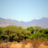
The goal of this project is to better understand how combined and interlinked changes in social and natural conditions and processes affect the resilience of riparian systems and, by extension, the ecosystem services these systems provide.

Monday, October 10, 2011

XIVth World Water Congress - Brazil!


Port de Galinhas, Brazil

In late September 2011, two members of the Riparian Resilience team, Lily House-Peters and Christopher Scott traveled to Porto de Galinhas to attend and present at the XIVth World Water Congress. In fact Dr. Scott was led the International Scientific Committee, a commendable feat!
The theme of the meeting was Adaptive Water Management: Looking to the Future. Lily presented a paper to an international audience interested in ecosystem services and global change titled, "Assessing the impacts of Land Use Change on Water Availability, Management, and Resilience in Arid Region Riparian Watersheds in Southwestern USA and Northern Mexico." The paper compared possible impacts to ecosystem service provisions, such as food, fiber, fuel, nutrient regulation, and erosion control, in each watershed under possible alternative futures. The paper stresses important link between maintaining the resilience (ie. functionality of the riparian system) and maintaining the ecosystem services that human communities rely on in the region. For example, if in the future there is limited winter precipitation with no flooding, the cottonwood tree forest in the riparian corridor would be vulnerable because seed dispersal and propagation depends on winter flood dynamics. The loss of the cottonwood forest would result in reduced erosion control, negatively impacting the livelihoods of farmers who cultivate land in the floodplain. This is especially important in the Rio San Miguel basin in Sonora, Mexico, where there is substantial flood plain agriculture.

The World Water Congress meeting was held in Porto de Galinhas, a small town located on the Northeastern coast of Brazil. The location was stunning, including a natural reef replete with colorful tropical fish.
Natural pool in the coral reef at low tide

Tropical fish in the reef

Eel

In addition to attending the conference in Porto de Galinhas, there was time to visit the large city of Recife and the UNESCO heritage site, Olinda, a colonial town 15 miles north of Recife.

Recife, Brazil

Downtown Recife

Fishing community in Recife

Colonial style buildings in Olinda

Cathedral in Olinda

Colorful parrot in Olinda

Sunday, August 28, 2011

Arizona Project WET -- Spring 2011

This past spring I had the opportunity to participate in the Arizona Project WET (Water Education for Teachers) Water Investigations Program as a Mentor Scientist. After completing a training course at the Water Resources Research Center, I and about 15 other mentor scientists went out into the field to help middle school students from Phoenix, Tucson, St. David and Florence, AZ implement water science investigations which they had designed with their teachers in class.

For my first field day, I led a group of students from St. David Elementary (St. David, AZ) at the Nature Conservancy's Three Links Farm property on the San Pedro River north of Benson, AZ. We conducted a study of streamflow in the San Pedro River at two points on the farm. Students learned how to calculate streamflow from the cross-sectional area of the stream and the average velocity of the water. They then compared the streamflows rates for our two study locations. We used a variety of materials including an electronic flow rate meter and a tape measure--just like the USGS!

St. David students got their feet--and much more--wet in the San Pedro River near Benson.

For my second day in the field, I met up with students from Haley Elementary (Chandler, AZ) at the Riparian Preserve at Water Ranch in Gilbert, AZ. We investigated how the amount of water in the ground affects the number of plants that live in the riparian environment. We did this by observing and recording plant types and concentrations at two points along a transect extending from the lake shore. We used a corer to extract soil cores, which we classified and estimated water content in the soil. The students analyzed the differences between the kinds of plants that grew closer to and further from the water's edge.


Students from Haley elementary take turns collecting soil core samples.

On both days we also did activities such as geocacheing to expose the students to a whole variety of techniques scientists use to collect data about riparian environments. After all the participating schools had their field days, everyone reconvened back at the University of Arizona Student Union for a research symposium. The students presented the findings of their water investigations in short oral presentations to their peers, just like professional scientists attending a conference. As a member of the NSF CNH Riparian Resilience project at UA, I really enjoyed this opportunity to be able to share my passion for and knowledge of our desert riparian areas with young students, many of whom had little exposure to Arizona's water resources in the past.

Thursday, June 30, 2011

Rio San Miguel - Field Visit to Rayon, Sonora, Mexico


On June 28th, in anticipation of the start of monsoon season, the Riparian Resilience team toured the Rio San Miguel watershed, visiting the town of Rayon, and scoping out the location of two existing Eddy Flux towers, to determine where a third tower should be sited as part of the Riparian Resilience project. Immediately we noticed the significant increase in humidity in the Rio San Miguel basin as compared to Tucson. Similar to our field visit to the San Pedro River watershed, the impact of the dry winter and spring season on the vegetation and the water levels in the river was evident.


Rayon, founded in 1638, is one of the largest towns in the Rio San Miguel basin with a population of about 2,000 people. Agriculture and ranching are important components of the local economy. Agricultural activities and grazing take place in the floodplain of the river. We saw small dams, built to provide irrigation water for agriculture, which impact the flow of the river, especially now, during the driest part of the year.

During the trip, we had the opportunity to gather water samples from the river, collect GPS point data detailing vegetation and land cover types for use in satellite image analysis, view wells in the area used for groundwater extraction, and visit eddy flux towers and other instruments currently situated in mesquite bosque and thornscrub dominated areas for collection of climate and energy flux information. We were also treated to impromptu bird watching in the riparian corridor, a haven for a number of colorful species of birds, who enjoy the abundant insects in the shallow pools of water.

Wednesday, May 18, 2011

Field Day, April 27th, 2011!


Wednesday, April 27th - the Riparian Resilience team headed to the field to scope out our research sites on the San Pedro River in southern Arizona and northern Sonora, Mexico and the Rio San Miguel, which flows south from northern Sonora into the city of Hermosillo.

We began the day with a tour of the San Pedro Riparian National Conservation Area (SPRNCA), a nationally protected riparian area since 1988. The cottonwood forest can be seen in the photos above.

We continued south, crossing the US-MX border in Naco, and followed the San Pedro to its headwaters outside of the mining city of Cananea, Mexico. We were surprised by the extent of the impact of the drought and the especially dry winter of 2010-2011 on the vegetation in northern Sonora. There was severe Mesquite tree mortality in several areas. Groundwater pumping to support the copper mine and urban population of Cananea and to support ranching activities are major sources of water consumption in the area, which impact the riparian corridor.
US-MX Border Crossing at Naco, Arizona

Copper Mine, Cananea, Mexico

Drought-induced Mesquite tree mortality, Sonora, MX
Well field, pumping groundwater for transport to the city of Cananea, MX

Ranching activities in northern Sonora, MX

Unfortunately, due to paperwork issues we were not able to visit our field sites along the Rio San Miguel on this trip. We did have the opportunity to meet up with our colleagues from Universidad de Sonora and Colegio de Sonora, which was a pleasure. Our next field visit is scheduled for mid-June, when we plan to spend 2 days collecting data along the Rio San Miguel and meeting with officials in Hermosillo and land owners in Sonora. In the meantime, Lily House-Peters and Robin Lewis have been traveling to meetings of the Upper San Pedro Partnership (USPP) in Sierra Vista and will begin to conduct interviews in southern Arizona in the coming weeks.

Please see the previous post for a link to more photos of our trip! (click on photo, which will automatically take you to the photo gallery)

Photos: San Pedro and Sonora Field Trip!

Tuesday, March 22, 2011

2011 Resilience Alliance Meeting - Phoenix, AZ

Four members of the Riparian Resilience team, Dr. Mitchell Pavao-Zuckerman, Dr. Tom Meixner, Lily House-Peters, and Robin Lewis, traveled to Phoenix, Arizona on March 12 to lead an exciting, interactive panel session at the 2011 Resilience Alliance Meeting.

We had a great turnout with nearly 40 people present for the presentations and 20 people who remained for the second hour to participate in the interactive activity. The first 45 minutes of presentations outlined the project goals and context, the ecohydrological dynamics, the social and institutional dynamics, and the modeling approaches for system coupling and the metrics to assess resilience in the bi-national San Pedro watershed. Then participants were divided into 5 groups of stakeholders (federal land agencies, military base representatives, conservation NGO's, urban developers, and the USPP consortium) to tackle contentious issues in the basin, namely climate change and water scarcity.

During the discussion portion of session, the following information was shared by each group:
1. Federal Land Agencies
  • In thinking about how we would approach the problem, “we all went towards our disciplines”
  • The scientists/modelers in the group stressed identifying tipping points, climate impacts, and using models
  • The policy-focused researchers in group put more stress on endangered species
  • Legislation and noted that the ESA is not an adaptive law; instead it tries to maintain the status quo.
  • Work with Bisbee and Sierra Vista on recharge and decreasing water use
  • Keep the military base, it prevents further urban development
2. Military Base:
  • Work on problems that arise from decreasing precipitation due to climate changeconnect with communities – be an example for them, share the best practices that are around
  • More intense flood events – re-defining the flood plains – what can be done to decrease problems from flooding
  • Decrease in summer demand from agriculture/ranching BUT increase in winter urban demand – one idea is to recharge the increased summer water for use when winter
  • Demand is up and precipitation is down– helpful also for the willows and other groundwater dependent plants
3. Conservation NGOs
  • Save the world
  • Raise awareness of water and ecosystem conditions – generate culture around the issues –focus on education and increasing public knowledge
  • Work together with other institutions – govt. agencies – establish regulations to meet benchmarks for water conservation – how can we achieve these benchmarks through collaboration?
  • Resource inventory – identify the biodiversity hotspots that should be prioritized and protected – encourage participation of citizen scientists – establish research agendas with the community to increase knowledge and monitoring of the water conditions and to better understand the ecological dynamics of the vegetation communities – more monitoring!
  • Work with developers to stress low-impact development – ex. stormwater management
4. Urban Developers:
  • We want to build cities! – but it is negotiable HOW we develop those cities
  • How do we design/build/advertise water-efficient development?
  • Use the best practices for conservation that have been developed at the Fort and scale them for urban/suburban development – BMPs
  • We have to attract buyers– attract a certain type of retirees who will become part of a community around water conservation (ex. Green Oldies)

5. USPP Stakeholder Consortium:
  • Each agency may not know how much of the resource (ex. water, land) that the other agencies are responsible for – make water usage among agencies transparent – then can model the impacts of the drought and flooding – so that the holistic condition of the SES can be understood
  • Have to tell the public the outcomes – not exactly how much water to stop using, but the overall impact on the system has to be told in a compelling way.
  • Provide alternatives and strategies
  • Land use change may be more of a critical factor than climate change! May want to focus more on the short-term impacts of land use change rather than climate change

Sunday, February 20, 2011

Project Inception Meeting - January, 28th, 2011

The past month has been especially productive for the Riparian Resilience project team. On Friday, January 28th, we held the Inception Meeting for the project in Tucson, Arizona. It was a great opportunity for the entire team, including our partners from Hermosillo, Mexico and Copenhagen, Denmark, to meet and lay the groundwork for the exciting and challenging interdisciplinary research that we are embarking on. A highlight of the Inception Meeting was the public hour, during which members of the project team presented the research problem, central questions, methodology, and goals for project outcomes. We drew a large and diverse crowd, with over 40 people in attendance, including faculty from departments across the University of Arizona, scientists from federal agencies such as USGS, and members of stakeholder groups and organizations currently tackling similar issues in the San Pedro watershed.
Throughout the day, members of the team worked to identify research synergies, pinpoint appropriate study sites in the US and Mexico within the two watersheds (the San Pedro and the Rio Sonora), strengthen international partnerships, and begin the process of conceptualizing the Agent-Based Modeling (ABM) system.

The team is now setting the first dates to conduct fieldwork in the watersheds in the coming month!

For more pictures from the Inception Meeting, see the photo link on the right side of the blog.

Sunday, January 23, 2011

Riparian Resilience

Questions we're interested in:

- How do we define tipping points or thresholds, when riparian systems (quickly) transform into alternate states? Can we recognize early signs of these transformations?

- How do coupled physical and human forces acting within riparian corridors, or remotely, influence thresholds and the conditions for reorganization following transformations?